
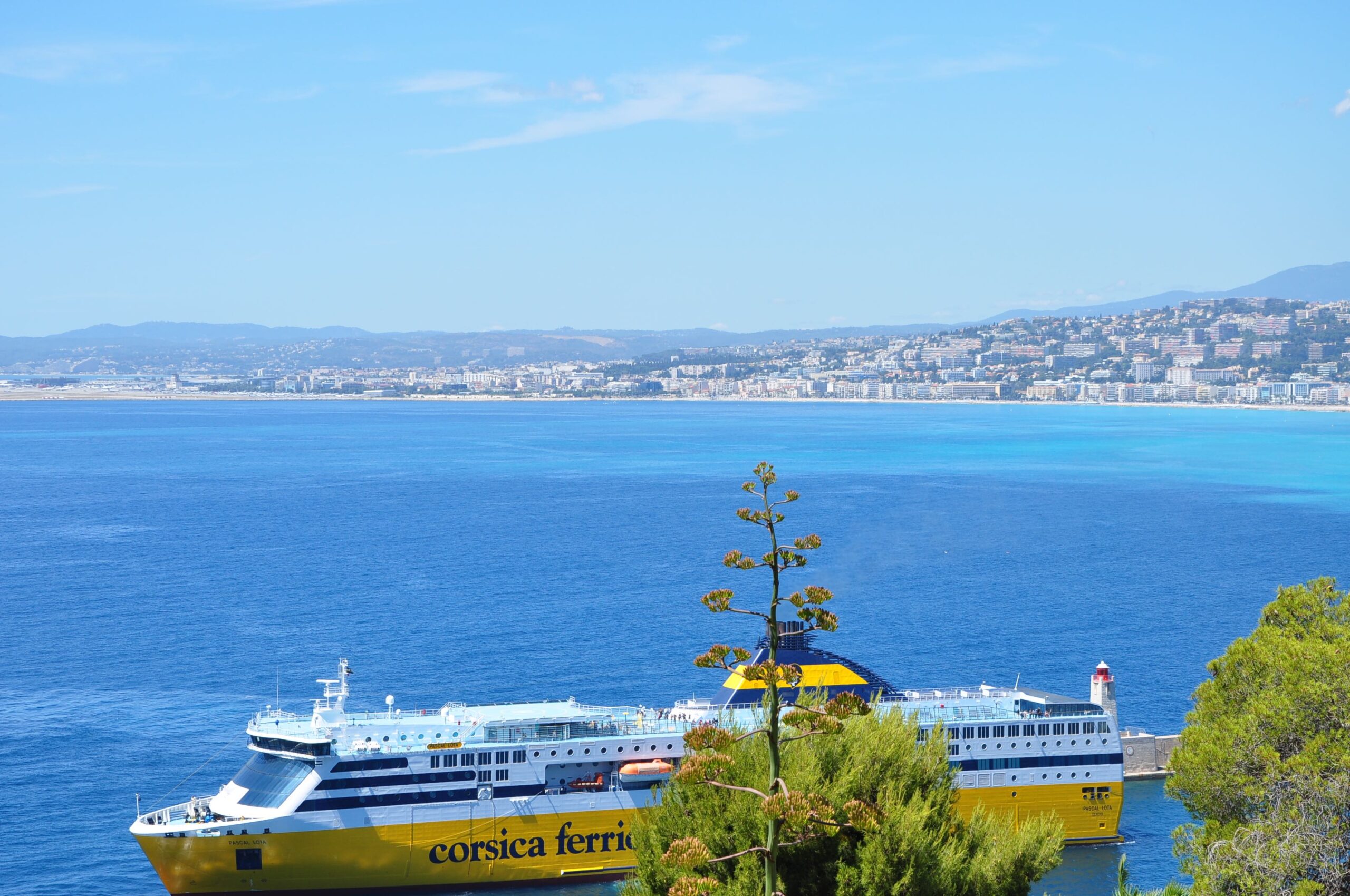
NICE AREA

The Nice area occupies one of the most varied stretches of the Côte d’Azur. From Villeneuve-Loubet in the west to Èze in the east, the coastline changes repeatedly over a distance that, on a map, seems remarkably small. Wide bays and flatter coastal land give way to Nice itself, and beyond the city the Alps move steadily closer to the Mediterranean until roads, railway lines and villages have to find their place between steep rock and sea.
Nice is the natural centre of this region, but it does not define all of it. To the west are Cagnes-sur-Mer, Saint-Laurent-du-Var and Villeneuve-Loubet, where the landscape is more open and the everyday connection with Nice, its airport and the surrounding business areas is strong. East of the city, the geography becomes much more dramatic. Villefranche-sur-Mer lies around its deep natural harbour, Beaulieu-sur-Mer occupies a rare piece of relatively level ground, Saint-Jean-Cap-Ferrat reaches out into the Mediterranean, and Èze rises steeply above the coast.
Behind all of this is another Côte d’Azur, often overlooked by visitors who remain close to the sea. Within a relatively short drive of the Promenade des Anglais, dense urban streets give way to villas, olive trees, wooded slopes and old hill villages. Understanding the Nice area therefore means looking not only from west to east, but also from the coast upwards.
Nice: the centre of the eastern Côte d’Azur
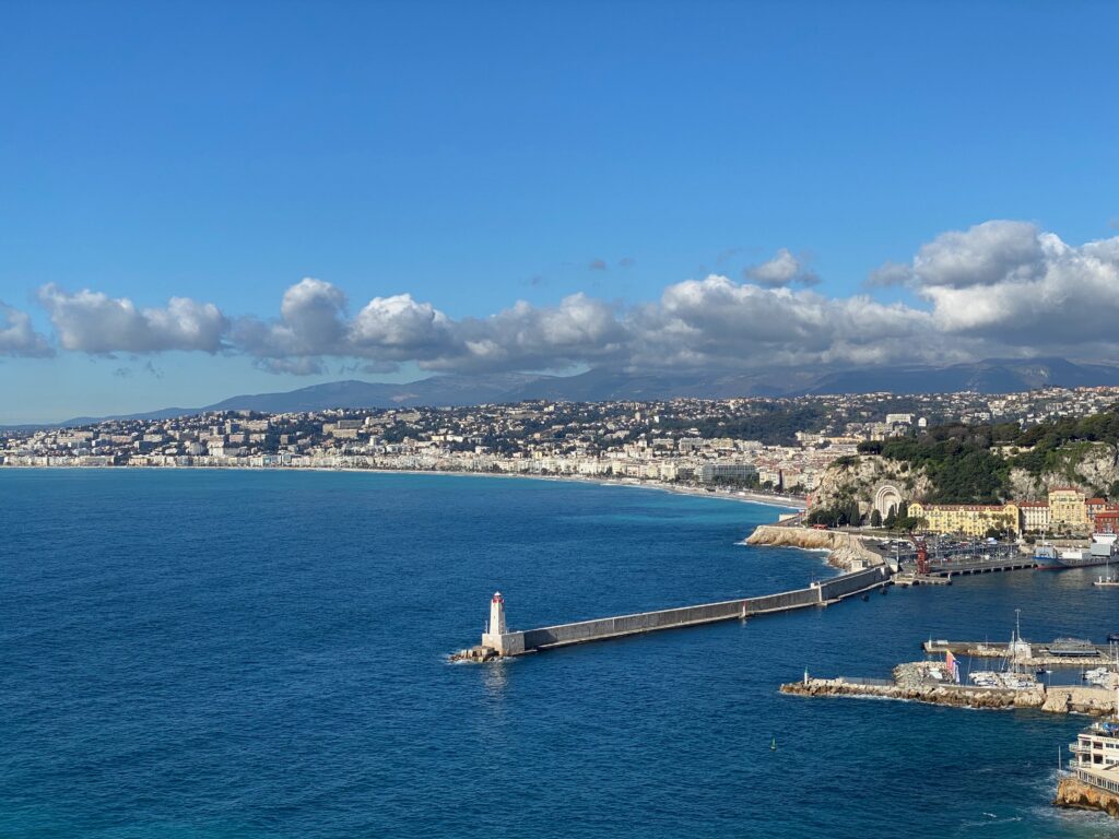
Nice is by far the largest city on the French Riviera and the place around which much of the eastern Côte d’Azur functions. Its international airport, railway connections, university, hospitals, shops and cultural institutions make it more than a resort town. Nice has a life of its own throughout the year, and that distinction becomes particularly noticeable outside the summer season.
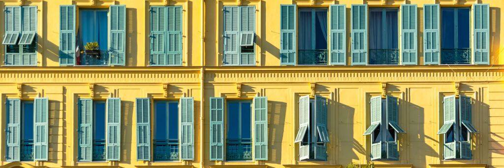
The city grew in layers. Vieux Nice, with its narrow streets between the Château hill and the Paillon, belongs to a much older Mediterranean city than the elegant quarters that later developed westwards. For centuries Nice was linked politically and culturally more closely to Savoy and Piedmont than to France. It became definitively French only in 1860, and the Italian influence remains visible in its architecture, street pattern, churches and food.
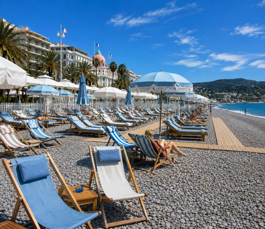
The nineteenth century transformed Nice. Wealthy British and other northern European visitors began spending their winters here, attracted by the mild climate rather than by summer beaches. Hotels, villas and gardens appeared along the coast and on the hills, while the path used by English winter residents for their seaside walks eventually became the Promenade des Anglais. Cimiez developed as a fashionable winter quarter, filled with grand apartment buildings and hotels, while the arrival of the railway accelerated the city’s expansion.
Modern Nice is consequently not one uniform urban environment. The Carré d’Or and the streets behind the Promenade are dense and central; the Port has its own architecture and rhythm; Cimiez feels more residential; and Mont Boron climbs rapidly towards villas, gardens and some of the city’s widest views. Further uphill, Nice continues for considerably longer than many visitors realise. A Nice address can mean an apartment from which almost everything is reached on foot, but equally a hillside villa for which a car is indispensable.
That variety is one of the main reasons Nice works differently from the smaller towns around it. It is possible to live here without organising daily life around the tourist season, and equally possible to use the city as a base for a second home without needing a car every time you want bread, dinner or a train.
West of Nice: a broader coastline
West of Nice, the landscape opens out. The mountains retreat from the shoreline, roads have more room and the coast becomes less compressed than it is on the eastern side of the city.
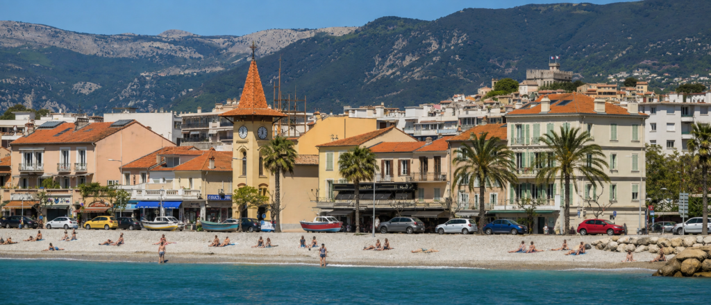
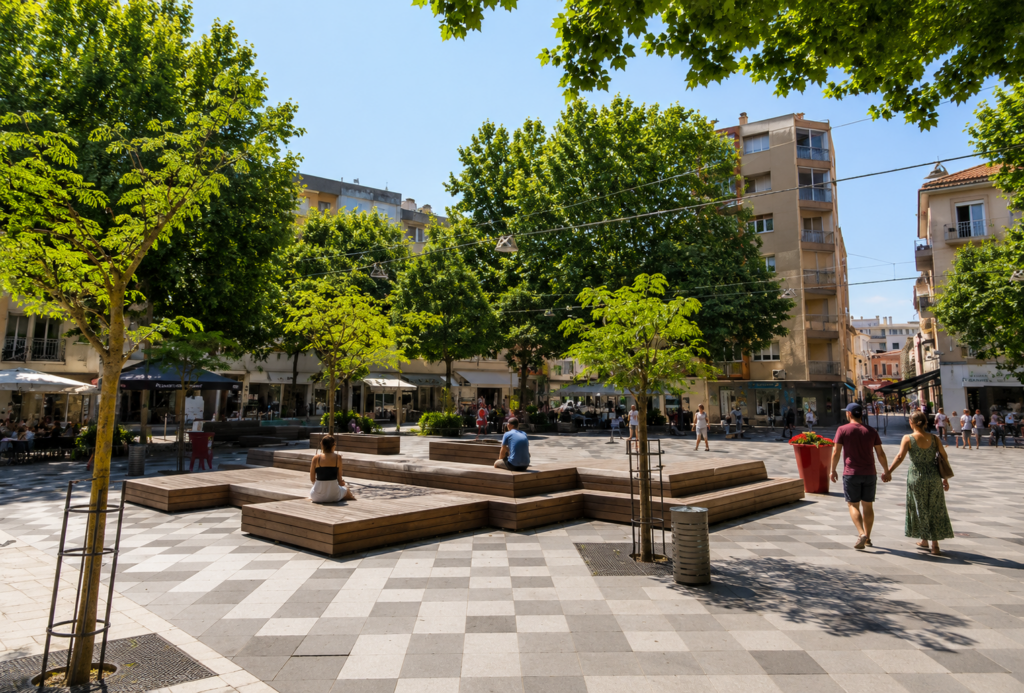
Saint-Laurent-du-Var begins almost immediately beyond Nice Airport. It is closely connected to the Nice metropolitan area and is more practical than picturesque in many parts, but that practicality is precisely why people live here. The railway, airport, major roads, shops and employment areas are all close at hand, while the old village sits slightly inland from the modern coastal development.
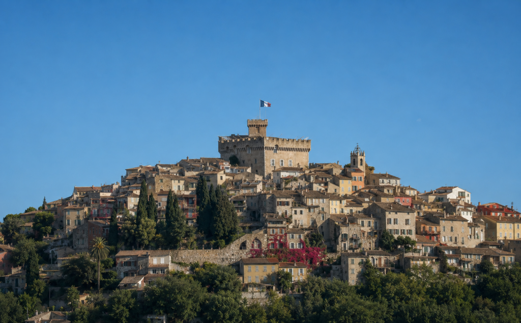
Beyond Saint-Laurent lies Cagnes-sur-Mer, a town whose character cannot really be understood from the seafront alone. Cros-de-Cagnes developed around an old fishing community and still has a noticeably different atmosphere from the modern centre. Above both stands Haut-de-Cagnes, the medieval village gathered around the Château Grimaldi. The climb between them is a reminder of how quickly the Côte d’Azur can change: within the same commune, a flat Mediterranean waterfront becomes a compact hill village with narrow lanes and views across the surrounding countryside.
Villeneuve-Loubet forms the western edge of the Nice area. Here again, the coast and the old settlement are quite separate. The medieval village lies inland in the valley of the Loup, while the coastline is dominated by Marina Baie des Anges, the enormous curved residential complex built from the late 1960s onwards. Whether one admires or dislikes its architecture, it has become one of the most recognisable pieces of twentieth-century building on this part of the coast.
This western part of the Nice area generally offers easier terrain and more room than the coast east of the city. It is also particularly convenient for the airport and the A8 motorway. The price of that convenience is a more developed landscape, with busy roads, commercial areas and modern apartment buildings forming a much greater part of the surroundings.tion and restaurant may make a very different choice from someone looking for privacy, land and a sea view.
East of Nice: where the mountains meet the sea
The landscape changes almost immediately east of Nice. Mont Boron rises behind the Port, and from here onwards there is increasingly little flat land between the Mediterranean and the mountains.
The Basse Corniche follows the coastline, the Moyenne Corniche runs higher along the slopes, and the Grande Corniche climbs higher still. These three roads are much more than scenic routes. They determine how this part of the Côte functions and explain why places that appear almost adjacent on a map can feel surprisingly separate in daily life.
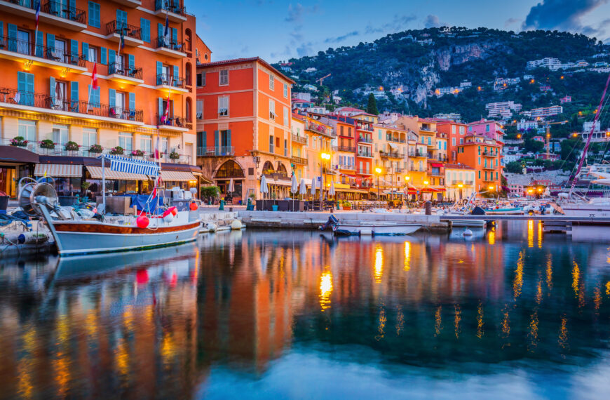
Villefranche-sur-Mer is the first of them. Its great natural bay has been strategically important for centuries, and the old town descends steeply towards the harbour. Buildings seem stacked above one another on the hillside, connected by stairs, narrow streets and passages. The geography that makes Villefranche so striking also shapes everyday life: height differences matter, parking matters, and the distance between a house and the waterfront cannot always be judged by looking at a map.
Yet Villefranche remains closely connected to Nice. The railway runs directly along the coast, and Nice is only a few minutes away by train. This combination, a small historic town with an extraordinary natural setting beside a major city, helps explain why property here has long been sought after.
Beaulieu-sur-Mer and Saint-Jean-Cap-Ferrat
Around the next headland, the terrain briefly relaxes. Beaulieu-sur-Mer occupies one of the relatively rare flatter areas along this stretch of coastline. Its centre, station, port and beaches lie within a compact area, making everyday life considerably easier on foot than in many of the surrounding hillside communities.
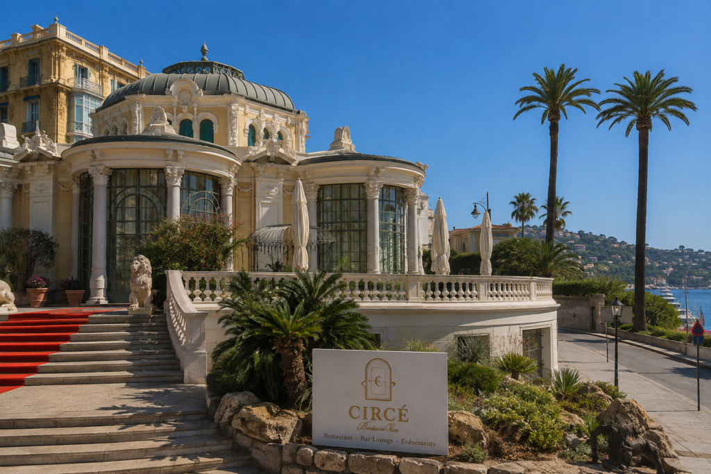
Beaulieu developed strongly during the Belle Époque, when wealthy European winter residents discovered this protected part of the coast. Villas, hotels and gardens from that period still help define the town. The Villa Kérylos, built in the early twentieth century as an extraordinary interpretation of an ancient Greek house, is perhaps the most obvious example of the intellectual and architectural ambitions of that era.
Next door, Saint-Jean-Cap-Ferrat extends into the Mediterranean on a long, green peninsula. Its development followed a different path. Large estates and villas occupied much of the peninsula, and the arrival of wealthy international residents created an unusually low-density landscape for such a valuable piece of coastline. The gardens and architecture of the Villa Ephrussi de Rothschild remain one of the clearest reminders of that period.
Beaulieu and Cap-Ferrat are often grouped together because they are neighbours, but living in them is not the same. Beaulieu has a recognisable town centre and railway station, while much of Cap-Ferrat is residential and deliberately secluded. The difference becomes particularly relevant when choosing between being able to walk to everyday amenities and having greater privacy and land.
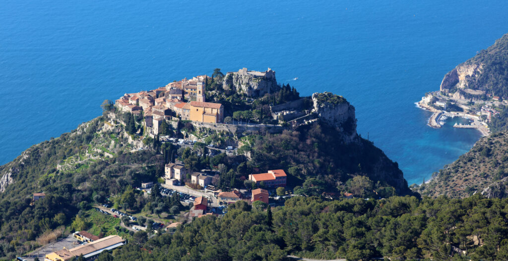
Èze: between the coast and the mountains
Beyond Beaulieu and Saint-Jean-Cap-Ferrat, the mountains close in again. Here the distinction between coast and hillside becomes particularly pronounced, and nowhere is that more obvious than in Èze.
Èze is perhaps the clearest example of why it is important to distinguish between a commune and its different parts. Èze Village sits dramatically high above the Mediterranean, its medieval streets occupying a rocky summit more than 400 metres above the sea. Èze-sur-Mer lies far below on the coast, while between them residential areas spread across the steep slopes around the Moyenne Corniche. They share a name and administration, but in everyday life they can feel like entirely different places.
The position of the old village was originally defensive. Like many settlements along this part of the Mediterranean, it was built high above the coast rather than beside it, where inhabitants were less exposed to attacks from the sea. What was once a practical choice has become the feature for which Èze is now famous: an extraordinary position overlooking the Mediterranean, with views extending towards Cap-Ferrat and far along the coastline.
That fame has consequences. Èze Village is one of the most visited places on the Côte d’Azur, and during the busiest months the narrow medieval streets can be crowded. Living in the commune, however, does not necessarily mean living among the visitors. Away from the historic centre are quiet residential roads, villas and gardens, often with wide views over the sea.
The differences in altitude matter in practical terms. Èze-sur-Mer has a railway station and direct access to the coast, while the village and the residential areas higher up depend much more heavily on the road network. The Moyenne Corniche provides connections towards both Nice and Monaco, but a property that appears close to the sea on a map may in reality be several hundred metres above it.
Èze forms the natural eastern edge of the Nice area. Continue towards Cap-d’Ail and Beausoleil and Monaco increasingly determines commuting patterns, daily life and the property market. Those places are therefore better understood as part of the Monaco area.
The hills behind Nice
The coastline receives most of the attention, but the hills immediately behind Nice form an important part of the region.
Nice is surrounded by rising land, and urban development gradually gives way to smaller communities such as Falicon, Aspremont and Tourrette-Levens. Further north, the landscape becomes increasingly rural. Olive groves, woodland and detached houses replace apartment blocks, even though the centre of Nice may still be relatively close in kilometres.
Historically, these villages belonged to an agricultural hinterland that supplied the coast. Their relationship with Nice changed as roads improved and the city expanded. Today many function partly as residential communities for people whose working and social lives remain connected to Nice, while retaining a scale and landscape very different from the city below.
Living here involves a different set of compromises from living on the coast. Houses are more likely to have gardens and
land, and summer nights can be noticeably cooler with increasing altitude. In return, a car becomes much more important and journey times depend heavily on the road and the time of day.
Orientation deserves attention as well. In a landscape of steep valleys and ridges, two houses only a short distance apart can receive very different amounts of winter sunlight. A magnificent summer view does not by itself tell you what a property will feel like in January.
Connections and everyday life
Few parts of the Côte d’Azur combine international accessibility with such a varied choice of living environments.
Nice Côte d’Azur Airport lies directly beside the city and is easily reached from the western coastal towns. From the east, the airport is further away but remains relatively accessible by road and public transport. Nice’s tram network connects the airport directly with the city, while the coastal railway provides an important alternative to driving between many of the towns.
The railway is particularly valuable east of Nice, where road traffic has to pass through a narrow geographical corridor. A home within walking distance of a station in Villefranche-sur-Mer or Beaulieu-sur-Mer can therefore function very differently from a villa several hundred metres higher on the hillside, even if the straight-line distance between them is small.
The same applies in Nice itself. Central neighbourhoods allow a largely pedestrian life, while the hills above the city almost automatically bring the car back into the equation. These practical differences are easy to underestimate when visiting for a few days. They become much more important when choosing somewhere to live.
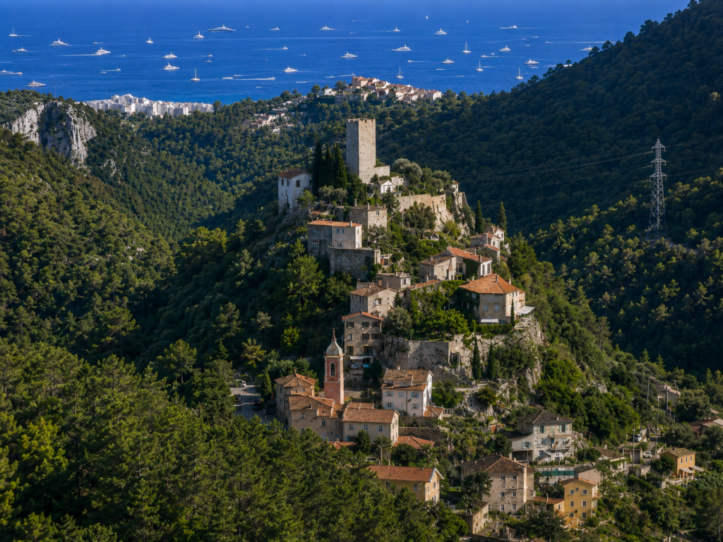 Tourrettes-Levens
Choosing where to live in the Nice area
The defining quality of the Nice area is not that it offers one particular version of the Côte d’Azur, but that several very different versions exist unusually close together.
To the west of Nice, the terrain is broader, access to the airport is easy and daily life is generally less constrained by steep slopes. Nice itself offers something rare on the Riviera: a substantial Mediterranean city where culture, healthcare, transport and ordinary urban life continue throughout the year. East of Nice, the landscape becomes more dramatic, available land scarcer and the relationship between sea, mountain and village much more pronounced. Behind the coast, the hills offer space and a quieter environment without necessarily moving very far from the city.
For someone considering a home here, the useful questions are therefore quite practical. Do you want to walk to restaurants and shops, or are you happy to drive? Do you need regular access to Monaco or the airport? Is a sea view more important than a flat walk into town? Do you want the activity of Nice around you, the scale of a smaller coastal town, or enough land to barely notice your neighbours?
Those choices matter more than the distance between the places on the map. And that is perhaps the best way to understand the Nice area: not as one destination, but as a narrow strip between the Mediterranean and the mountains in which geography has created a surprising number of very different places to live.

Curious about Properties for sale in this region?
Or Explore our Website